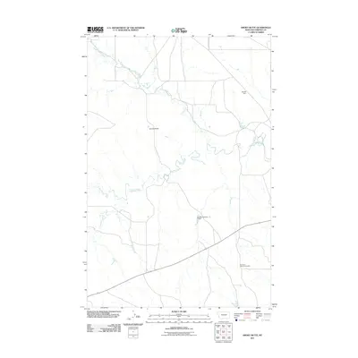
2011 Map of Smoky Butte
USGS Topo · Published 2011About this map
Smoky Butte rises as a prominent landmark in this section of Garfield County, overlooking a landscape defined by the winding course of Big Dry Creek. The drainage patterns here are complex, with Smoky Butte Creek and Lone Tree Creek feeding into the larger waterway. Human presence is marked by infrastructure designed for water management in an arid environment, including Brusett Dam and Big Mac Number 1 Dam. Local history and genealogy are centered around The Zions Lutheran Cemetery, which sits in the southeastern portion of the quadrangle. Transport through this prairie terrain is facilitated by several local routes, notably Barney Murnion Rd, reflecting the rural ranching character of the region during this 2011 survey.
Find a feature on this map
8 named features on this map. Tap any name to fly to it.
Don’t see what you’re looking for? This feature index may not catch every label — zoom into the map to look around manually.
Map Details
Editions of this 2011 Smoky Butte Map
This is the sole edition of this map. No revisions or reprints were ever made.
Other maps of this area

1954 · Jordan
USGS Topo · 1:250,000

1956 · Jordan
USGS Topo · 1:250,000

1958 · Jordan
USGS Topo · 1:250,000

1964 · Jordan
USGS Topo · 1:250,000

1964 · Jordan NW
USGS Topo · 1:24,000

1964 · Jordan
USGS Topo · 1:24,000

1965 · Big Dry School
USGS Topo · 1:24,000

1965 · Darby Buttes
USGS Topo · 1:24,000

1965 · Ziegele Coulee
USGS Topo · 1:24,000
1983 · Jordan
USGS Topo · 1:100,000