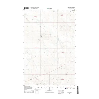
2014 Map of Smoky Butte
USGS Topo · Published 2014About this map
Smoky Butte rises as a prominent landmark in this segment of Garfield County, marking a transition between the northern drainage of Smoky Butte Cr and the southern flow of Big Dry Cr. The landscape is defined by the high elevations of the Piney Buttes in the northeast, which overlook a series of coulees and ridges typical of the Missouri River breaks region. Human presence is sparse but concentrated along local travel routes like McDonald Ln and the more significant MT-200 corridor. For genealogists and local historians, The Zions Lutheran Cem stands as a vital record of the area's settlers in the southeastern corner of the quadrangle. The map captures the vast township and range divisions, showing the enduring ranching and rural structure of this Montana prairie.
Find a feature on this map
16 named features on this map. Tap any name to fly to it.
Don’t see what you’re looking for? This feature index may not catch every label — zoom into the map to look around manually.
Map Details
Editions of this 2014 Smoky Butte Map
This is the sole edition of this map. No revisions or reprints were ever made.
Other maps of this area

1954 · Jordan
USGS Topo · 1:250,000

1956 · Jordan
USGS Topo · 1:250,000

1958 · Jordan
USGS Topo · 1:250,000

1964 · Jordan
USGS Topo · 1:250,000

1964 · Jordan NW
USGS Topo · 1:24,000

1964 · Jordan
USGS Topo · 1:24,000

1965 · Big Dry School
USGS Topo · 1:24,000

1965 · Darby Buttes
USGS Topo · 1:24,000

1965 · Ziegele Coulee
USGS Topo · 1:24,000
1983 · Jordan
USGS Topo · 1:100,000