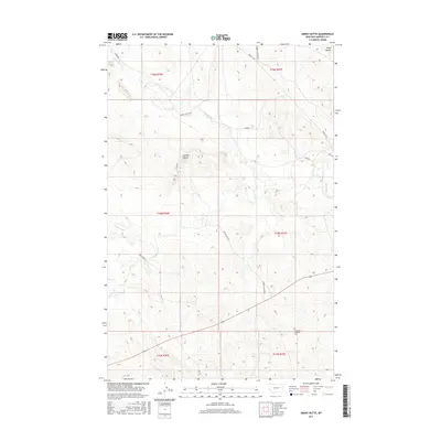
2017 Map of Smoky Butte
USGS Topo · Published 2017About this map
Smoky Butte and the Piney Buttes dominate this high plains landscape in Garfield County, where the elevation reaches over 2,900 feet in the northern reaches. The terrain is defined by a network of drainage channels including Smoky Butte Cr and Lone Tree Cr, which cut through the open rangeland. A sense of the area's agricultural and social history is grounded by The Zions Lutheran Cem in the southeastern quadrant, a focal point for researchers of local genealogy. The road network, including the eponymous Smokey Butte Rd and Barney Murnion Rd, traces the section lines of the Public Land Survey System, illustrating how land division and ranching access dictated the development of this rural Montana territory.
Find a feature on this map
21 named features on this map. Tap any name to fly to it.
Don’t see what you’re looking for? This feature index may not catch every label — zoom into the map to look around manually.
Map Details
Editions of this 2017 Smoky Butte Map
This is the sole edition of this map. No revisions or reprints were ever made.
Other maps of this area

1954 · Jordan
USGS Topo · 1:250,000

1956 · Jordan
USGS Topo · 1:250,000

1958 · Jordan
USGS Topo · 1:250,000

1964 · Jordan
USGS Topo · 1:250,000

1964 · Jordan NW
USGS Topo · 1:24,000

1964 · Jordan
USGS Topo · 1:24,000

1965 · Big Dry School
USGS Topo · 1:24,000

1965 · Darby Buttes
USGS Topo · 1:24,000

1965 · Ziegele Coulee
USGS Topo · 1:24,000
1983 · Jordan
USGS Topo · 1:100,000