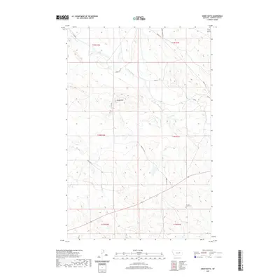
2020 Map of Smoky Butte
USGS Topo · Published 2020About this map
Smoky Butte rises as a prominent landmark in this section of Garfield County, characterized by a sparse network of ranch roads and intermittent drainages. The landscape is defined by the winding course of Big Dry Creek and its various tributaries, including Smoky Butte Cr and Lone Tree Cr. This 2020 survey highlights the rural persistence of the region, where infrastructure is primarily limited to numbered routes like 17308 Rd and named thoroughfares such as Brusett Rd and Barney Murnion Rd. A notable point of historical and genealogical interest is The Zions Lutheran Cem, situated in the southeastern portion of the quadrangle. In the north, the Piney Buttes provide additional topographic relief, while the Smokey Butte Rd serves as a primary artery through this cattle-country terrain.
Find a feature on this map
21 named features on this map. Tap any name to fly to it.
Don’t see what you’re looking for? This feature index may not catch every label — zoom into the map to look around manually.
Map Details
Editions of this 2020 Smoky Butte Map
This is the sole edition of this map. No revisions or reprints were ever made.
Other maps of this area

1954 · Jordan
USGS Topo · 1:250,000

1956 · Jordan
USGS Topo · 1:250,000

1958 · Jordan
USGS Topo · 1:250,000

1964 · Jordan
USGS Topo · 1:250,000

1964 · Jordan NW
USGS Topo · 1:24,000

1964 · Jordan
USGS Topo · 1:24,000

1965 · Big Dry School
USGS Topo · 1:24,000

1965 · Darby Buttes
USGS Topo · 1:24,000

1965 · Ziegele Coulee
USGS Topo · 1:24,000
1983 · Jordan
USGS Topo · 1:100,000