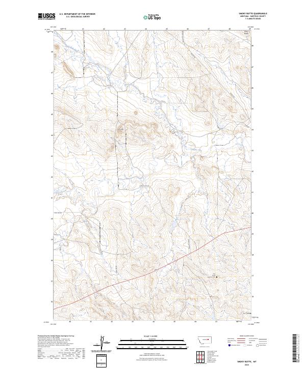
2024 Map of Smoky Butte
USGS Topo · Published 2024About this map
Smoky Butte dominates the central landscape of this Garfield County survey, rising above a network of drainages that includes Big Dry Creek and Smoky Butte Creek. The terrain is defined by its series of distinct high points, such as Piney Buttes in the northeast, which served as critical landmarks for local navigation in this part of Montana. For genealogists and local historians, The Zion's Lutheran Cem near the southern boundary provides a significant point of record for the area's rural community. A system of local roads, including Barney Murnion Rd and Brusett Rd, connects these remote sections, tracing the paths of earlier ranching and transport routes through the creek valleys and over the rugged breaks.
Find a feature on this map
19 named features on this map. Tap any name to fly to it.
Don’t see what you’re looking for? This feature index may not catch every label — zoom into the map to look around manually.
Map Details
Editions of this 2024 Smoky Butte Map
This is the sole edition of this map. No revisions or reprints were ever made.
Other maps of this area

1954 · Jordan
USGS Topo · 1:250,000

1956 · Jordan
USGS Topo · 1:250,000

1958 · Jordan
USGS Topo · 1:250,000

1964 · Jordan
USGS Topo · 1:250,000

1964 · Jordan NW
USGS Topo · 1:24,000

1964 · Jordan
USGS Topo · 1:24,000

1965 · Big Dry School
USGS Topo · 1:24,000

1965 · Darby Buttes
USGS Topo · 1:24,000

1965 · Ziegele Coulee
USGS Topo · 1:24,000
1983 · Jordan
USGS Topo · 1:100,000