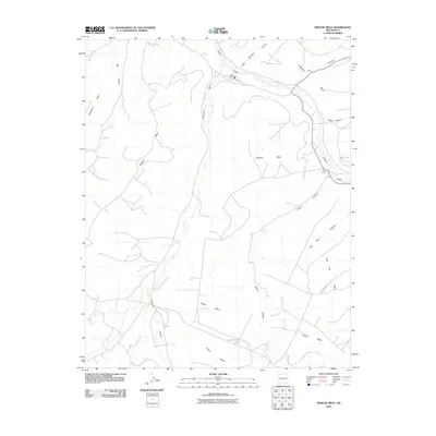
2010 Map of Smouse Mesa
USGS Topo · Published 2010About this map
Largo Canyon and its many offshoots, including Encimada Canyon and Dogie Canyon, define this high-desert landscape in San Juan County. The terrain is characterized by a series of broad, flat-topped landforms like Smouse Mesa, Superior Mesa, and Thompson Mesa, which are separated by deep drainages such as Palluche Canyon. Human presence is sparse and concentrated along these natural corridors, with Largo Camp situated near the junction of several washes and Truby Ranch tucked further south into the canyon system.
Find a feature on this map
21 named features on this map. Tap any name to fly to it.
Don’t see what you’re looking for? This feature index may not catch every label — zoom into the map to look around manually.
Map Details
Editions of this 2010 Smouse Mesa Map
This is the sole edition of this map. No revisions or reprints were ever made.
Other maps of this area

1889 · Largo
USGS Topo · 1:250,000

1895 · Largo
USGS Topo · 1:250,000

1954 · Aztec
USGS Topo · 1:250,000

1958 · Aztec
USGS Topo · 1:250,000

1959 · Gould Pass
USGS Topo · 1:62,500

1959 · Nageezi
USGS Topo · 1:62,500

1962 · Aztec
USGS Topo · 1:250,000

1963 · Tayfoya Canyon
USGS Topo · 1:24,000

1963 · Gonzales Mesa
USGS Topo · 1:24,000
1963 · Santos Peak
USGS Topo · 1:24,000