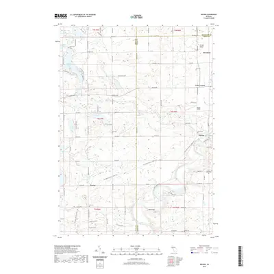
2019 Map of Smyrna
USGS Topo · Published 2019About this map
The Flat River winds through the heart of this West Michigan landscape, anchoring a series of small settlements and recreational corridors. In the south, the village of Smyrna sits at the confluence of the river and Seely Cr, while the former rail alignment is now preserved as the Fred Meijer Flat River Valley Trail. This trail follows the winding river valley through Moseley toward the northern boundary of Belding. This area is particularly rich for genealogical research, containing a high density of rural burial grounds such as Saint Mary's Catholic Cem, Otisco Cem, and Mason Cem. The northern sections are dominated by numerous glacial lakes, including Big Pine Island Lake, Tower Lake, and Slayton Lake, illustrating the transition from the river-bottom agriculture to the lake-studded terrain common in this portion of the state.
Find a feature on this map
68 named features on this map. Tap any name to fly to it.
Don’t see what you’re looking for? This feature index may not catch every label — zoom into the map to look around manually.
Map Details
Editions of this 2019 Smyrna Map
This is the sole edition of this map. No revisions or reprints were ever made.
Other maps of this area

1916 · Ionia
USGS Topo · 1:62,500

1918 · Ionia
USGS Topo · 1:62,500

1918 · Lowell
USGS Topo · 1:62,500

1943 · Ionia
USGS Topo · 1:62,500

1943 · Lowell
USGS Topo · 1:62,500

1954 · Midland
USGS Topo · 1:250,000

1958 · Midland
USGS Topo · 1:250,000

1958 · Grand Rapids
USGS Topo · 1:250,000

1959 · Midland
USGS Topo · 1:250,000

1961 · Grand Rapids
USGS Topo · 1:250,000