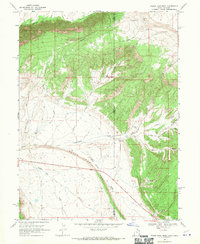
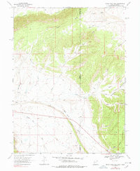
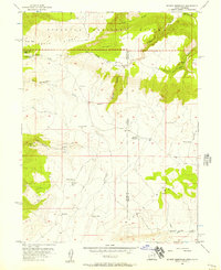
1968 Map of Snake John Reef
USGS Topo · Published 1970About this map
Snake John Reef dominates the central landscape of this 1960s topographic study, marking a sharp geological divide along the border of Uintah and Moffat Counties. This high-desert terrain is defined by dramatic elevations and deep drainages, including Buckwater Canyon and Bull Canyon to the east. Human presence is sparse and largely utilitarian, centered on ranching and early resource exploration. Evidence of local homesteading and livestock operations appears at Jensen Cabin, K Ranch, and a lone Corral near Miners Creek. A network of primitive jeep trails and trails provides the only access through the ridges. The survey captures the area just as energy infrastructure began to traverse the remote basin, evidenced by a pipeline cutting across the southwestern corner near Raven Ridge. Water remains the most critical resource for the few inhabitants, with vital points like Snake John Spring and a Flowing Well scattered across the arid draws.
Find a feature on this map
33 named features on this map. Tap any name to fly to it.
Don’t see what you’re looking for? This feature index may not catch every label — zoom into the map to look around manually.
Map Details
Editions of this 1968 Snake John Reef Map
2 editions found
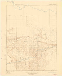
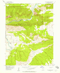
Other maps of this area

1885 · Ashley
USGS Topo · 1:250,000

1907 · Rangely
USGS Topo · 1:125,000

1907 · Jensen
USGS Topo · 1:125,000

1910 · Jensen
USGS Topo · 1:125,000
1910 · Rangely
USGS Topo · 1:125,000
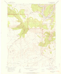
1954 · Hells Canyon
USGS Topo · 1:24,000

1954 · Vernal
USGS Topo · 1:250,000
1955 · Stuntz Reservoir
USGS Topo · 1:24,000
1955 · Split Mountain
USGS Topo · 1:24,000

1958 · Vernal
USGS Topo · 1:250,000