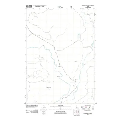
2011 Map of Snake River Butte
USGS Topo · Published 2011About this map
Henrys Fork and the Warm River converge in this corner of Idaho, creating a landscape defined by significant water features and recreational sites. The descent of the river system is marked by the dramatic Upper Mesa Falls and Lower Mesa Falls, with the Grandview Overlook providing a vantage point over the canyon. Near the small settlement of Gerrit, the Warm River Fish Hatchery and Warm River Spring highlight the importance of the local aquatic ecosystem. The map also captures the varied land use of the early 21st century, from the Bear Gulch Ski Area and Bear Gulch Campground to the industrial Bear Gulch Gravel Pit. Notable elevations such as Snake River Butte and Elk Butte overlook a network of forest and service roads like Pioneer Rd and Warm River Rd, which connect the remote terrain to water control points like Cherry Dam.
Find a feature on this map
38 named features on this map. Tap any name to fly to it.
Don’t see what you’re looking for? This feature index may not catch every label — zoom into the map to look around manually.
Map Details
Editions of this 2011 Snake River Butte Map
This is the sole edition of this map. No revisions or reprints were ever made.
Other maps of this area

1955 · Ashton
USGS Topo · 1:250,000

1957 · Warm River Butte
USGS Topo · 1:62,500

1957 · Buffalo Lake
USGS Topo · 1:62,500

1958 · Ashton
USGS Topo · 1:250,000

1960 · Ashton
USGS Topo · 1:250,000

1964 · Hatchery Butte
USGS Topo · 1:24,000

1964 · Last Chance
USGS Topo · 1:24,000

1965 · Ashton
USGS Topo · 1:24,000

1965 · Lookout Butte
USGS Topo · 1:24,000

1965 · Snake River Butte
USGS Topo · 1:24,000