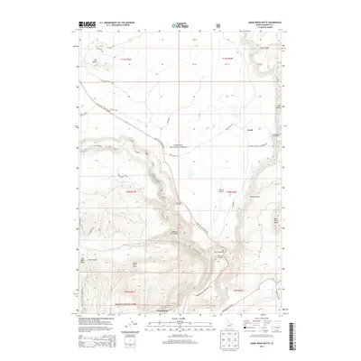
2013 Map of Snake River Butte
USGS Topo · Published 2013About this map
Upper Mesa Falls and Lower Mesa Falls dominate this stretch of the Henry's Fork river corridor, where the water cuts through dramatic volcanic geology. This area within the Targhee National Forest serves as a significant recreational and ecological hub, anchored by the Warm River Fish Hatchery and the Bear Gulch Ski Area. The map reveals a complex network of forest roads like the Mesa Falls Scenic Byway and Warm River Rd that navigate the high-elevation terrain between Snake River Butte and Big Bend Ridge. Small settlements such as Gerrit and Warm River provide evidence of local development centered on the river's resources. From the Grandview Overlook to the quiet waters of Beaver Pond, the landscape is defined by the sharp transition from high buttes to deeply carved river canyons.
Find a feature on this map
46 named features on this map. Tap any name to fly to it.
Don’t see what you’re looking for? This feature index may not catch every label — zoom into the map to look around manually.
Map Details
Editions of this 2013 Snake River Butte Map
This is the sole edition of this map. No revisions or reprints were ever made.
Other maps of this area

1955 · Ashton
USGS Topo · 1:250,000

1957 · Warm River Butte
USGS Topo · 1:62,500

1957 · Buffalo Lake
USGS Topo · 1:62,500

1958 · Ashton
USGS Topo · 1:250,000

1960 · Ashton
USGS Topo · 1:250,000

1964 · Hatchery Butte
USGS Topo · 1:24,000

1964 · Last Chance
USGS Topo · 1:24,000

1965 · Ashton
USGS Topo · 1:24,000

1965 · Lookout Butte
USGS Topo · 1:24,000

1965 · Snake River Butte
USGS Topo · 1:24,000