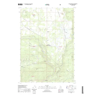
2020 Map of Snake River Butte
USGS Topo · Published 2020About this map
Upper Mesa Falls and Lower Mesa Falls punctuate the deep descent of the Henry's Fork as it carves through the volcanic geology of the Targhee National Forest. This 2020 survey documents the intersection of modern recreation and ancient terrain, highlighting the massive Henrys Fork Caldera and Island Park Caldera that dominate the northern topography. While the settlement of Gerrit provides a human footprint on the eastern edge, much of the landscape remains defined by a complex network of forest access roads like Anderson Mill Canyon Rd and the Mesa Falls Scenic Byway. Significant geological features such as Snake River Butte, Warm River Butte, and the striking Hole in Rocks provide clear navigation points for researchers and visitors tracing the high-altitude drainage of the Warm River and its numerous tributaries.
Find a feature on this map
58 named features on this map. Tap any name to fly to it.
Don’t see what you’re looking for? This feature index may not catch every label — zoom into the map to look around manually.
Map Details
Editions of this 2020 Snake River Butte Map
This is the sole edition of this map. No revisions or reprints were ever made.
Other maps of this area

1955 · Ashton
USGS Topo · 1:250,000

1957 · Warm River Butte
USGS Topo · 1:62,500

1957 · Buffalo Lake
USGS Topo · 1:62,500

1958 · Ashton
USGS Topo · 1:250,000

1960 · Ashton
USGS Topo · 1:250,000

1964 · Hatchery Butte
USGS Topo · 1:24,000

1964 · Last Chance
USGS Topo · 1:24,000

1965 · Ashton
USGS Topo · 1:24,000

1965 · Lookout Butte
USGS Topo · 1:24,000

1965 · Snake River Butte
USGS Topo · 1:24,000