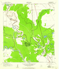
1943 Map of Snipe
USGS Topo · Published 1959About this map
Oyster Creek winds through the heart of this Brazoria County landscape, defining the intricate drainage patterns of the Texas coastal plain during the early 1940s. The settlement of Lake Jackson appears in its formative stages, showing a distinct circular street plan adjacent to the Lake Jackson School. This development sits between the expansive Retrieve State Farm to the northwest and Clemens State Farm to the southwest, highlighting the significant role of state-managed agricultural lands in the local economy of the era.
Find a feature on this map
39 named features on this map. Tap any name to fly to it.
Don’t see what you’re looking for? This feature index may not catch every label — zoom into the map to look around manually.
Map Details
Editions of this 1943 Snipe Map
2 editions found
Other maps of this area

1943 · Oyster Creek
USGS Topo · 1:31,680

1943 · Jones Creek
USGS Topo · 1:31,680

1943 · Danbury
USGS Topo · 1:31,680

1943 · Freeport
USGS Topo · 1:31,680

1943 · Angleton
USGS Topo · 1:24,000

1943 · Snipe
USGS Topo · 1:31,680

1950 · Houston
USGS Topo · 1:250,000

1951 · Bay City
USGS Topo · 1:250,000

1952 · Cedar Lane NE
USGS Topo · 1:24,000

1952 · East Columbia
USGS Topo · 1:24,000