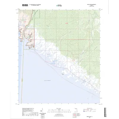
2024 Map of Snipe Island
USGS Topo · Published 2024About this map
The coastal wetlands of Taylor and Jefferson Counties are defined by a complex network of tidal creeks and marshes where the Aucilla River and Econfina River meet the Gulf of Mexico. This coastal landscape is dominated by the Saint Marks National Wildlife Refuge and the Saint Marks Wilderness, areas preserved to maintain the shoreline's primitive character. The topography is a labyrinth of water features including Snipe Creek, Smokehouse Creek, and Sulfur Creek.
Find a feature on this map
43 named features on this map. Tap any name to fly to it.
Don’t see what you’re looking for? This feature index may not catch every label — zoom into the map to look around manually.
Map Details
Editions of this 2024 Snipe Island Map
This is the sole edition of this map. No revisions or reprints were ever made.
Other maps of this area

1949 · Apalachicola
USGS Topo · 1:250,000

1954 · Johnson Hammock
USGS Topo · 1:24,000

1954 · St. Marks NE
USGS Topo · 1:24,000

1954 · Cobb Rocks
USGS Topo · 1:24,000

1954 · Gainesville
USGS Topo · 1:250,000

1954 · Valdosta
USGS Topo · 1:250,000

1954 · Tallahassee
USGS Topo · 1:250,000

1955 · Snipe Island
USGS Topo · 1:24,000

1955 · Nutall Rise
USGS Topo · 1:24,000

1955 · Rock Islands
USGS Topo · 1:24,000