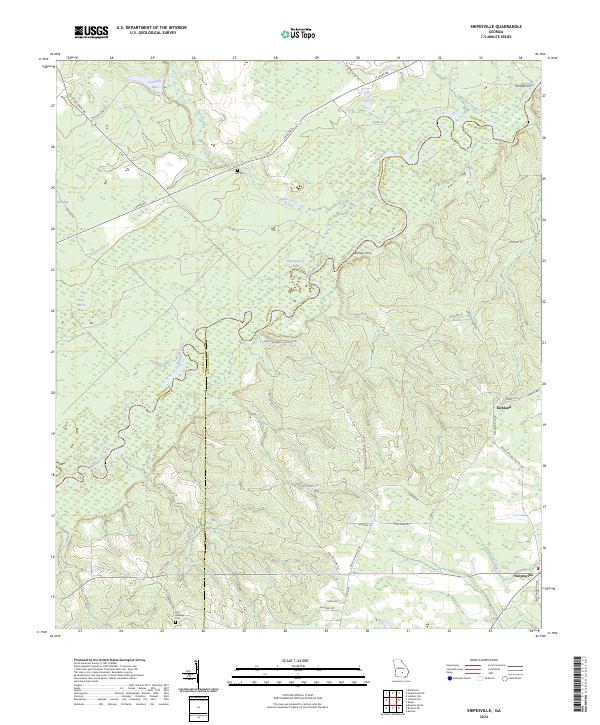
2024 Map of Snipesville
USGS Topo · Published 2024About this map
The Ocmulgee River carves a winding path through this corner of Jeff Davis County, defining the borders with Telfair and Coffee counties. This riverine landscape is marked by historical crossing points like Ashleys Ferry and Burketts Ferry, which historically linked these rural timber and farming communities across the water. To the south, the settlement of Kirkland sits near the headwaters of Hurricane Creek, while Snipesville occupies the southeastern corner of the quadrangle. Genealogists will find interest in localized landmarks such as Hall Cem near Horse Creek and Saint Andrews Cem further south. The geography is characterized by distinct wetland features including Dan Bland Bay and Still Bay, alongside numerous lakes like Varnadoe Lake and Montgomery Lake that dot the river basin.
Find a feature on this map
49 named features on this map. Tap any name to fly to it.
Don’t see what you’re looking for? This feature index may not catch every label — zoom into the map to look around manually.
Map Details
Editions of this 2024 Snipesville Map
This is the sole edition of this map. No revisions or reprints were ever made.
Other maps of this area

1953 · Waycross
USGS Topo · 1:250,000

1958 · Waycross
USGS Topo · 1:250,000

1971 · Roper
USGS Topo · 1:24,000

1971 · Jacksonville NE
USGS Topo · 1:24,000

1971 · Snipesville
USGS Topo · 1:24,000

1971 · Broxton NE
USGS Topo · 1:24,000

1971 · Denton
USGS Topo · 1:24,000
1971 · Lumber City
USGS Topo · 1:24,000

1972 · Broxton North
USGS Topo · 1:24,000

1972 · Jacksonville
USGS Topo · 1:24,000