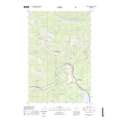
2020 Map of Snoqualmie Pass
USGS Topo · Published 2020About this map
Snoqualmie Pass serves as the central hub of this mountain corridor, where the dividing line between King and Kittitas counties meets. The landscape is defined by its transit history, following the winding Wagon Road and the engineering of the Snoqualmie Tunnel. Settlements like Hyak, Rockdale, and Denny Creek sit along the primary transport artery, while the surrounding high country of the Snoqualmie National Forest and Wenatchee National Forest is carved by the Middle Fork Snoqualmie Wild and Scenic River. The map details a dense network of high-elevation landmarks, from the thermal waters of Goldmyer Hot Springs to the footpaths of the Pacific Crest National Scenic Trail. Noteworthy alpine features such as Keechelus Lake and the steep profiles of Snoqualmie Mtn and The Tooth illustrate the challenging terrain that necessitated the complex infrastructure found here.
Find a feature on this map
102 named features on this map. Tap any name to fly to it.
Don’t see what you’re looking for? This feature index may not catch every label — zoom into the map to look around manually.
Map Details
Editions of this 2020 Snoqualmie Pass Map
This is the sole edition of this map. No revisions or reprints were ever made.
Other maps of this area

1901 · Snoqualmie Pass
USGS Topo · 1:125,000

1902 · Skykomish
USGS Topo · 1:125,000

1903 · Snoqualmie
USGS Topo · 1:125,000

1905 · Skykomish
USGS Topo · 1:125,000

1913 · Cedar Lake
USGS Topo · 1:125,000

1921 · Sultan
USGS Topo · 1:125,000

1923 · Sultan
USGS Topo · 1:125,000

1957 · Wenatchee
USGS Topo · 1:250,000

1960 · Mount Si
USGS Topo · 1:62,500

1960 · Bandera
USGS Topo · 1:62,500