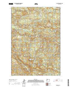
2020 Map of Snow Peak
USGS Topo · Published 2020About this map
Snow Peak anchors the southern portion of this landscape, serving as the high point for a complex drainage system in the Cascades. To the north, Jordan Valley sits along the banks of Jordan Cr, while the high-altitude Indian Prairie and its namesake Indian Prairie Lake occupy the central south. The map reveals a dense network of waterways, including the winding Thomas Creek and the Roaring River, which carve through the elevations. Local transport is represented by rural routes such as E McCully Mountain Rd and Thomas Creek Dr, providing access to remote landmarks like Devils Den. This survey captures the topographic transition between the creek valleys and the higher mountain peaks, documenting the hydrology of the Linn County border region with specific detail on minor tributaries like Criminal Cr and Hortense Cr.
Find a feature on this map
34 named features on this map. Tap any name to fly to it.
Don’t see what you’re looking for? This feature index may not catch every label — zoom into the map to look around manually.
Map Details
Editions of this 2020 Snow Peak Map
This is the sole edition of this map. No revisions or reprints were ever made.
Other maps of this area

1929 · Mill City
USGS Topo · 1:125,000

1951 · Lyons
USGS Topo · 1:62,500

1951 · Snow Peak
USGS Topo · 1:62,500

1953 · Salem
USGS Topo · 1:250,000

1954 · Salem
USGS Topo · 1:250,000

1955 · Mill City
USGS Topo · 1:62,500

1956 · Quartzville
USGS Topo · 1:62,500

1960 · Salem
USGS Topo · 1:250,000

1962 · Salem
USGS Topo · 1:250,000

1963 · Salem
USGS Topo · 1:250,000