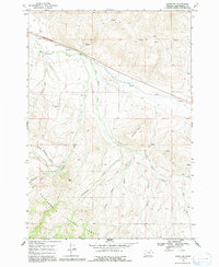
1968 Map of Snowline
USGS Topo · Published 1991About this map
Snowline Ranch and the small siding of Junction anchor the high-country landscape of Beaverhead County in the late 1960s. Situated along the corridor of Route 91 and Interstate 15, this area shows the intersection of modern transportation with traditional ranching and timber lands within the Beaverhead National Forest. The map documents a complex drainage system where Snowline Creek and Big Beaver Creek carve through the terrain, joined by numerous named watercourses like Crooked Run Creek and Warm Springs Creek.
Find a feature on this map
24 named features on this map. Tap any name to fly to it.
Don’t see what you’re looking for? This feature index may not catch every label — zoom into the map to look around manually.
Map Details
Editions of this 1968 Snowline Map
3 editions found
Other maps of this area

1955 · Dubois
USGS Topo · 1:250,000

1957 · Paul Reservoir
USGS Topo · 1:62,500

1957 · Edie Ranch
USGS Topo · 1:62,500

1958 · Dubois
USGS Topo · 1:250,000

1965 · Lima
USGS Topo · 1:24,000

1965 · Lima Peaks
USGS Topo · 1:24,000

1968 · Lima Dam
USGS Topo · 1:24,000

1968 · Snowline
USGS Topo · 1:24,000

1968 · Monida
USGS Topo · 1:24,000

1968 · Henry Gulch
USGS Topo · 1:24,000