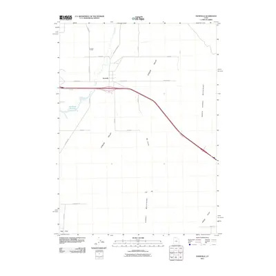
2011 Map of Snowville
USGS Topo · Published 2011About this map
Snowville serves as the central hub of this northern Utah landscape, situated at a transition between the Curlew Valley and the North Hansel Mountains. The town's layout and surrounding road network, including the Holbrook-Stone Rd and Locomotive Rd, reflect its position as a crossroads near the Idaho border. Local history is anchored at the Snowville Cemetery north of the main settlement, while the presence of Deep Creek and the Rose Ranch Reservoir highlights the critical role of water management in this arid high-desert environment.
Find a feature on this map
26 named features on this map. Tap any name to fly to it.
Don’t see what you’re looking for? This feature index may not catch every label — zoom into the map to look around manually.
Map Details
Editions of this 2011 Snowville Map
This is the sole edition of this map. No revisions or reprints were ever made.
Other maps of this area

1954 · Pocatello
USGS Topo · 1:250,000

1954 · Brigham City
USGS Topo · 1:250,000

1958 · Pocatello
USGS Topo · 1:250,000

1958 · Brigham City
USGS Topo · 1:250,000

1962 · Brigham City
USGS Topo · 1:250,000

1968 · Salt Wells
USGS Topo · 1:24,000

1968 · Rattlesnake Pass
USGS Topo · 1:24,000

1968 · Snowville
USGS Topo · 1:24,000
1968 · Bulls Pass
USGS Topo · 1:24,000

1968 · Monument Peak
USGS Topo · 1:24,000