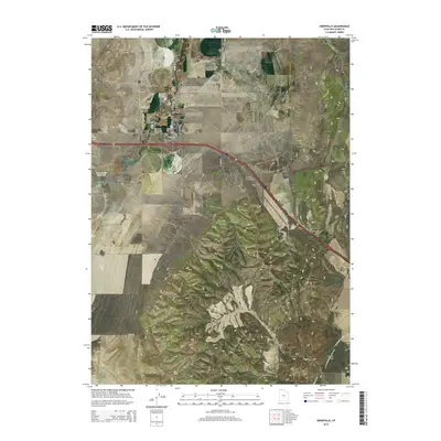
2014 Map of Snowville
USGS Topo · Published 2014About this map
Snowville sits as a crossroads for northern Utah travel, positioned where the Curlew Valley meets the rising terrain of the Hansel Mountains. This 2014 survey captures the township's established grid, including the Snowville Cem and local infrastructure like the Rose Ranch Reservoir. The landscape is defined by its dramatic elevation changes, transitioning from the open floor of Sage Valley and Hansel Valley to high-altitude features like Calf Flat and Big Canyon. Drainage for the region is marked by the winding path of Deep Cr, which cuts through the valley floor. The map provides a precise look at the rural road network, which remains vital for connecting these isolated basins across the northern reaches of the state near the Idaho border.
Find a feature on this map
31 named features on this map. Tap any name to fly to it.
Don’t see what you’re looking for? This feature index may not catch every label — zoom into the map to look around manually.
Map Details
Editions of this 2014 Snowville Map
This is the sole edition of this map. No revisions or reprints were ever made.
Other maps of this area

1954 · Pocatello
USGS Topo · 1:250,000

1954 · Brigham City
USGS Topo · 1:250,000

1958 · Pocatello
USGS Topo · 1:250,000

1958 · Brigham City
USGS Topo · 1:250,000

1962 · Brigham City
USGS Topo · 1:250,000

1968 · Salt Wells
USGS Topo · 1:24,000

1968 · Rattlesnake Pass
USGS Topo · 1:24,000

1968 · Snowville
USGS Topo · 1:24,000
1968 · Bulls Pass
USGS Topo · 1:24,000

1968 · Monument Peak
USGS Topo · 1:24,000