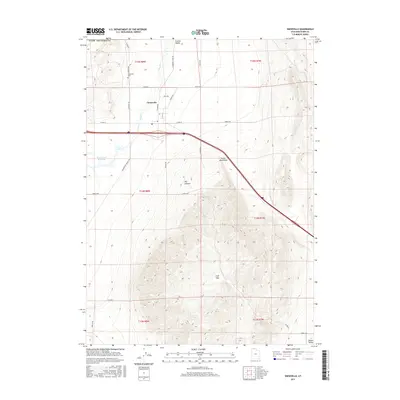
2017 Map of Snowville
USGS Topo · Published 2017About this map
Snowville serves as the primary hub of this high-desert landscape in Box Elder County, positioned where the Curlew Valley meets the northern reaches of the Hansel Mountains. The town's grid is centered near the intersection of W Main St and Cemetary Rd, with the Snowville Cem situated just to the west. This mapping shows the modern infrastructure supporting the ranching and agricultural life of the region, including the Rose Ranch Reservoir and the drainage of Deep Cr. The terrain transitions from the open flats of Calf Flat to the more dramatic topography of Big Canyon. A network of rural routes, such as Locomotive Springs Rd and Dairy Rd, provides access across the basin-and-range geography, illustrating how the community remains anchored to the land and its water sources.
Find a feature on this map
28 named features on this map. Tap any name to fly to it.
Don’t see what you’re looking for? This feature index may not catch every label — zoom into the map to look around manually.
Map Details
Editions of this 2017 Snowville Map
This is the sole edition of this map. No revisions or reprints were ever made.
Other maps of this area

1954 · Pocatello
USGS Topo · 1:250,000

1954 · Brigham City
USGS Topo · 1:250,000

1958 · Pocatello
USGS Topo · 1:250,000

1958 · Brigham City
USGS Topo · 1:250,000

1962 · Brigham City
USGS Topo · 1:250,000

1968 · Salt Wells
USGS Topo · 1:24,000

1968 · Rattlesnake Pass
USGS Topo · 1:24,000

1968 · Snowville
USGS Topo · 1:24,000
1968 · Bulls Pass
USGS Topo · 1:24,000

1968 · Monument Peak
USGS Topo · 1:24,000