
1960 Map of Snyder
USGS Topo · Published 1961About this map
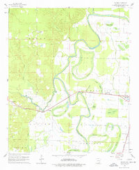
Bayou Bartholomew winds through this 1960 landscape, defining the transition from the forested ridges in the west to the flat, alluvial plains of the east. The Missouri Pacific railroad serves as the primary industrial corridor, linking the settlements of Snyder, Thebes, and the town of Montrose. This transport network supported a local economy rooted in timber and agriculture, evidenced by the numerous brakes and sloughs like Simpson Brake and Holloway Brake that mark the low-lying terrain.
Find a feature on this map
40 named features on this map. Tap any name to fly to it.
Don’t see what you’re looking for? This feature index may not catch every label — zoom into the map to look around manually.
Map Details
Editions of this 1960 Snyder Map
2 editions found
Other maps of this area

1935 · Mist
USGS Topo · 1:62,500

1935 · Wilmot
USGS Topo · 1:62,500

1936 · Eudora
USGS Topo · 1:62,500

1936 · Lake Village
USGS Topo · 1:62,500

1953 · Greenwood
USGS Topo · 1:250,000

1955 · Lake Village
USGS Topo · 1:62,500

1956 · Greenwood
USGS Topo · 1:250,000

1957 · Eudora
USGS Topo · 1:62,500

1960 · Mist
USGS Topo · 1:62,500

1960 · Wilmot
USGS Topo · 1:62,500