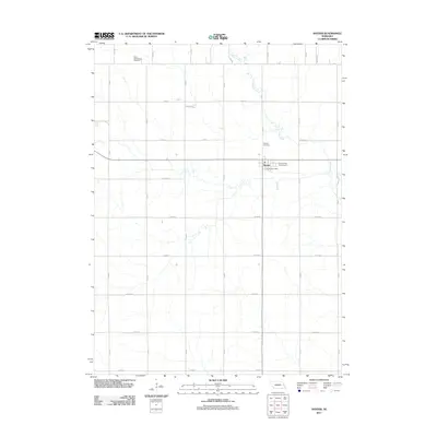
2011 Map of Snyder
USGS Topo · Published 2011About this map
Snyder serves as the central hub of this agricultural landscape in Dodge County, situated at the intersection of a strictly gridded section-line road network. The village is anchored by essential local infrastructure including the Snyder Post Office and the Fireman Park Campground, reflecting the community's civic and social focus during the early twenty-first century. The surrounding terrain is defined by the winding course of Pebble Creek, which cuts a sinuous path through the rectilinear layout of county roads such as Co Rd 7 and Co Rd 8. For genealogists and local historians, the map identifies two significant burial sites: the Saint Wenceslaus Cemetery in the northwest and the Snyder Cemetery located just north of the town site. These features, along with the numerous named thoroughfares like A Rd and 9th Rd, document the enduring spatial organization of this Nebraska farming district.
Find a feature on this map
30 named features on this map. Tap any name to fly to it.
Don’t see what you’re looking for? This feature index may not catch every label — zoom into the map to look around manually.
Map Details
Editions of this 2011 Snyder Map
This is the sole edition of this map. No revisions or reprints were ever made.
Other maps of this area

1955 · Fremont
USGS Topo · 1:250,000

1957 · Fremont
USGS Topo · 1:250,000

1958 · Fremont
USGS Topo · 1:250,000

1966 · Scribner SW
USGS Topo · 1:24,000

1966 · Monterey
USGS Topo · 1:24,000

1966 · Webster
USGS Topo · 1:24,000

1966 · Snyder
USGS Topo · 1:24,000

1966 · Aloys
USGS Topo · 1:24,000

1966 · Scribner
USGS Topo · 1:24,000
1966 · West Point
USGS Topo · 1:24,000