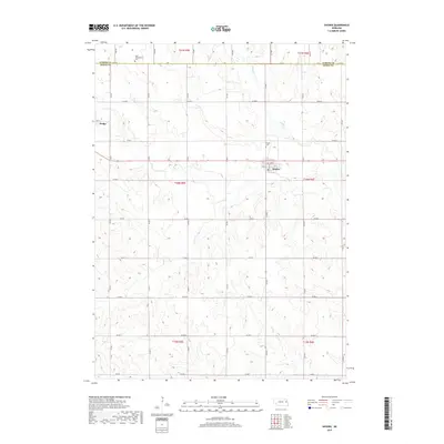
2017 Map of Snyder
USGS Topo · Published 2017About this map
The village of Snyder and the eastern edge of Dodge anchor this landscape along the border of Cuming and Dodge Counties. This agricultural region is defined by a systematic grid of section roads, including Co Rd A through Co Rd I, which partition the rolling plains between drainage basins. Pebble Cr meanders through the northern sections, providing a natural break in the geometric road network that connects these rural communities. Local history is anchored by the Saint Wenceslaus Cem in the north and Snyder Cem just north of its namesake village. The map provides a clear view of the organized development of eastern Nebraska, showing how the local infrastructure serves both the established settlements and the surrounding farmland during the early twenty-first century.
Find a feature on this map
25 named features on this map. Tap any name to fly to it.
Don’t see what you’re looking for? This feature index may not catch every label — zoom into the map to look around manually.
Map Details
Editions of this 2017 Snyder Map
This is the sole edition of this map. No revisions or reprints were ever made.
Other maps of this area

1955 · Fremont
USGS Topo · 1:250,000

1957 · Fremont
USGS Topo · 1:250,000

1958 · Fremont
USGS Topo · 1:250,000

1966 · Scribner SW
USGS Topo · 1:24,000

1966 · Monterey
USGS Topo · 1:24,000

1966 · Webster
USGS Topo · 1:24,000

1966 · Snyder
USGS Topo · 1:24,000

1966 · Aloys
USGS Topo · 1:24,000

1966 · Scribner
USGS Topo · 1:24,000
1966 · West Point
USGS Topo · 1:24,000