
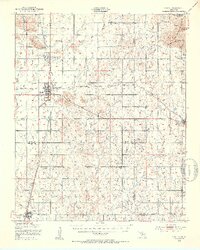
1950 Map of Snyder
USGS Topo · Published 1953About this map
The Wichita Mountains dominate the northern landscape of this mid-century survey, where the rugged outcrops of the Charons Garden Mountains, Broken Hills, and Sunset Peak give way to the sprawling plains below. The town of Snyder serves as a central hub, situated at the junction of the St Louis San Francisco railroad lines and the Scenic Highway. The surrounding rural landscape is defined by a network of small country schools and cemeteries that reflect the dispersed agricultural community of the era. To the north, Mountain Park sits near the base of the mountains and the Mountain Park Cem, while further south, the terrain transitions into the Bad Lands and the drainage basins of Deep Red Run and Horse Creek. This survey captures the region's development before the later intensification of water management, showing original drainage patterns like Otter Creek and the early footprint of Snyder Lake.
Find a feature on this map
34 named features on this map. Tap any name to fly to it.
Don’t see what you’re looking for? This feature index may not catch every label — zoom into the map to look around manually.
Map Details
Editions of this 1950 Snyder Map
2 editions found
Other maps of this area

1937 · Cache
USGS Topo · 1:48,000

1937 · Quanah Mountain
USGS Topo · 1:24,000

1942 · Cache
USGS Topo · 1:62,500

1949 · Cooperton
USGS Topo · 1:62,500

1949 · Quanah Mountain
USGS Topo · 1:24,000

1950 · Saddle Mountain
USGS Topo · 1:62,500

1955 · Lawton
USGS Topo · 1:250,000

1956 · Post Oak Creek
USGS Topo · 1:24,000

1956 · Glen Mountains
USGS Topo · 1:24,000

1956 · Saddle Mountain
USGS Topo · 1:24,000