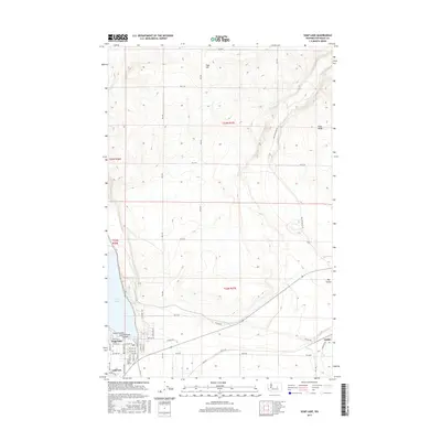
2017 Map of Soap Lake
USGS Topo · Published 2017About this map
Soap Lake anchors the southern portion of this landscape, where the town of the same name meets the geological formations of the Grand Coulee. The area is defined by sharp topographic contrasts, with the steep elevations of High Hill and Pinto Ridge overlooking the floor of the Dry Coulee. The town site of Soap Lake is clearly detailed with its local street grid, including Main Ave E and Division Rd NW, as well as the local Po. To the east, the small settlement of Adrian sits near the confluence of the terrain and Crab Cr, while Lakeview occupies the western shore. The map illustrates a developed network of rural roads like RD B Ne and Dry Coulee RD NE, tracing the paths between agricultural sections and the unique mineral waters of the lake.
Find a feature on this map
45 named features on this map. Tap any name to fly to it.
Don’t see what you’re looking for? This feature index may not catch every label — zoom into the map to look around manually.
Map Details
Editions of this 2017 Soap Lake Map
This is the sole edition of this map. No revisions or reprints were ever made.
Other maps of this area

1953 · Ritzville
USGS Topo · 1:250,000

1956 · Ephrata
USGS Topo · 1:62,500

1956 · Stratford
USGS Topo · 1:24,000

1956 · Ephrata
USGS Topo · 1:24,000

1956 · Grant Orchards
USGS Topo · 1:24,000

1956 · Gloyd
USGS Topo · 1:24,000

1956 · Soap Lake
USGS Topo · 1:24,000

1959 · Ritzville
USGS Topo · 1:250,000

1965 · Ritzville
USGS Topo · 1:250,000

1965 · Jameson Lake SE
USGS Topo · 1:24,000