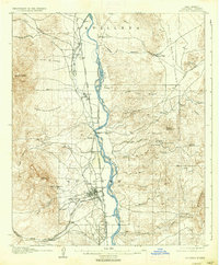
1906 Map of Socorro
USGS Topo · Published 1937About this map
Socorro and its industrial landscape are documented here at the turn of the century, showing a community built around the Rio Grande and early New Mexico mining efforts. The School of Mines sits on the western edge of town, signaling the area's role as an educational and technical hub during a period of significant mineral exploration. Evidence of this extraction is found in the nearby mountains, including the Dewey Mine and Torrance Mine.
Find a feature on this map
64 named features on this map. Tap any name to fly to it.
Don’t see what you’re looking for? This feature index may not catch every label — zoom into the map to look around manually.
Map Details
Editions of this 1906 Socorro Map
3 editions found
Other maps of this area

1906 · Socorro
USGS Topo · 1:62,500

1916 · La Joya
USGS Topo · 1:125,000

1948 · Carthage
USGS Topo · 1:62,500

1948 · San Antonio
USGS Topo · 1:62,500

1952 · San Anacia
USGS Topo · 1:24,000

1952 · La Joya
USGS Topo · 1:24,000

1952 · Becker SW
USGS Topo · 1:24,000

1954 · Tularosa
USGS Topo · 1:250,000

1954 · Socorro
USGS Topo · 1:250,000

1958 · Socorro
USGS Topo · 1:250,000