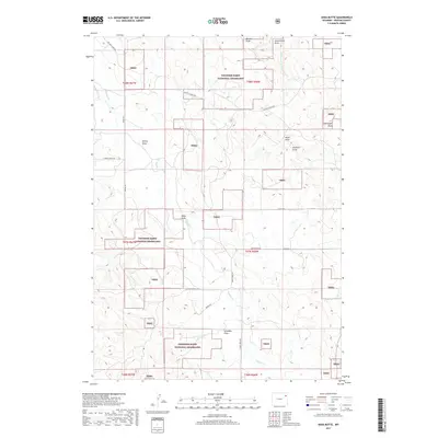
2017 Map of Soda Butte
USGS Topo · Published 2017About this map
Thunder Basin National Grassland dominates this portion of Weston County, where a vast network of drainage draws and intermittent creeks defines the high plains landscape. Named topographical features like Soda Butte and family-named landmarks such as Schoeber Draw, Stellwagon Draw, and Brainard Draw indicate the history of local ranching and land use in this semi-arid region. Water remains the primary shaper of the terrain, with Buffalo Cr and its tributaries, including the Middle Fork Wind Cr, carving deep into the plateau. The map details a remote transportation network essential for livestock and resource management, including Old Four-Horse Rd, Dowdy Rd, and Materi Rd. This survey reflects the modern management of public and private grazing lands, where section lines and range boundaries intersect with the natural flow of the S Br Beaver Cr drainage system.
Find a feature on this map
28 named features on this map. Tap any name to fly to it.
Don’t see what you’re looking for? This feature index may not catch every label — zoom into the map to look around manually.
Map Details
Editions of this 2017 Soda Butte Map
This is the sole edition of this map. No revisions or reprints were ever made.
Other maps of this area

1918 · Moorcroft
USGS Topo · 1:125,000

1954 · Gillette
USGS Topo · 1:250,000

1955 · Newcastle
USGS Topo · 1:250,000

1955 · Gillette
USGS Topo · 1:250,000

1957 · Upton
USGS Topo · 1:62,500

1958 · Gillette
USGS Topo · 1:250,000

1958 · Newcastle
USGS Topo · 1:250,000

1962 · Gillette
USGS Topo · 1:250,000

1979 · Newcastle
USGS Topo · 1:100,000

1979 · Sundance
USGS Topo · 1:100,000