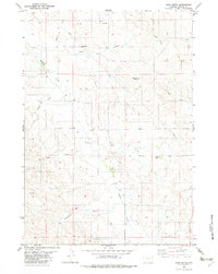
1982 Map of Soda Butte
USGS Topo · Published 1982About this map
Soda Butte and Goose Butte rise above a landscape defined by an intricate network of drainage draws and energy infrastructure in this Weston County quadrangle. The terrain is marked by a legacy of resource extraction, evidenced by numerous Drill Hole locations, a prominent Pipeline, and a Pumping Sta. The natural hydrology is dominated by Buffalo Creek and Wind Creek, fed by named seasonal channels such as Madren Draw, Alkali Draw, and Schoeber Draw. These features reflect the industrial and ranching character of the Wyoming high plains in the early 1980s.
Find a feature on this map
16 named features on this map. Tap any name to fly to it.
Don’t see what you’re looking for? This feature index may not catch every label — zoom into the map to look around manually.
Map Details
Editions of this 1982 Soda Butte Map
This is the sole edition of this map. No revisions or reprints were ever made.
Other maps of this area

1918 · Moorcroft
USGS Topo · 1:125,000

1954 · Gillette
USGS Topo · 1:250,000

1955 · Newcastle
USGS Topo · 1:250,000

1955 · Gillette
USGS Topo · 1:250,000

1957 · Upton
USGS Topo · 1:62,500

1958 · Gillette
USGS Topo · 1:250,000

1958 · Newcastle
USGS Topo · 1:250,000

1962 · Gillette
USGS Topo · 1:250,000

1979 · Newcastle
USGS Topo · 1:100,000

1979 · Sundance
USGS Topo · 1:100,000