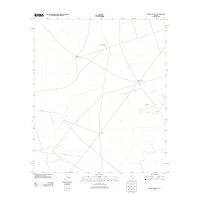
2013 Map of Soda Lake NE
USGS Topo · Published 2013About this map
Little Joe Oil Field and a series of numbered water sources define this section of the Permian Basin in Winkler County. The landscape is characterized by the sparse infrastructure typical of West Texas energy and ranching operations, where life and industry depend on scattered water points like China Windmill, Windmill Number Two, and Windmill Number Four. A network of unpaved tracks and service roads, including PVT Road 4052, provides the primary access through this arid terrain. This 2013 survey illustrates the continued importance of historical wind-powered wells in an area increasingly dominated by petroleum extraction, showing the functional layout of a modern oil field alongside traditional ranching landmarks.
Find a feature on this map
6 named features on this map. Tap any name to fly to it.
Don’t see what you’re looking for? This feature index may not catch every label — zoom into the map to look around manually.
Map Details
Editions of this 2013 Soda Lake NE Map
This is the sole edition of this map. No revisions or reprints were ever made.
Other maps of this area

1954 · Pecos
USGS Topo · 1:250,000

1957 · Pecos
USGS Topo · 1:250,000

1961 · Soda Lake
USGS Topo · 1:24,000

1967 · Soda Lake NW
USGS Topo · 1:24,000

1968 · Soda Lake SE
USGS Topo · 1:24,000

1968 · Wink South
USGS Topo · 1:24,000

1968 · Soda Lake NE
USGS Topo · 1:24,000
1969 · Pyote West
USGS Topo · 1:24,000

1969 · Cheyenne Draw SW
USGS Topo · 1:24,000

1970 · Wink North
USGS Topo · 1:24,000