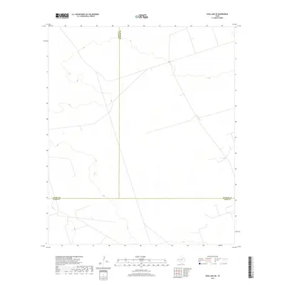
2019 Map of Soda Lake NE
USGS Topo · Published 2019About this map
The convergence of Loving, Winkler, and Ward counties defines this quiet stretch of West Texas desert. This late-2010s survey reveals a landscape largely devoid of permanent settlements, instead shaped by the administrative geometry of county lines and a sparse network of local roads and unimproved paths. The terrain is characterized by subtle elevation changes and the presence of ephemeral water features typical of the Permian Basin region. While the map is sparse in named landmarks, the intersection of these three county boundaries provides a clear geographic anchor for researchers tracing regional land use and the progression of modern energy infrastructure across the Trans-Pecos landscape.
Find a feature on this map
3 named features on this map. Tap any name to fly to it.
Don’t see what you’re looking for? This feature index may not catch every label — zoom into the map to look around manually.
Map Details
Editions of this 2019 Soda Lake NE Map
This is the sole edition of this map. No revisions or reprints were ever made.
Other maps of this area

1954 · Pecos
USGS Topo · 1:250,000

1957 · Pecos
USGS Topo · 1:250,000

1961 · Soda Lake
USGS Topo · 1:24,000

1967 · Soda Lake NW
USGS Topo · 1:24,000

1968 · Soda Lake SE
USGS Topo · 1:24,000

1968 · Wink South
USGS Topo · 1:24,000

1968 · Soda Lake NE
USGS Topo · 1:24,000
1969 · Pyote West
USGS Topo · 1:24,000

1969 · Cheyenne Draw SW
USGS Topo · 1:24,000

1970 · Wink North
USGS Topo · 1:24,000