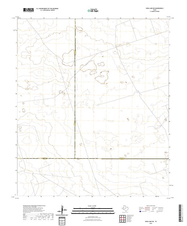
2022 Map of Soda Lake NE
USGS Topo · Published 2022About this map
The convergence of Loving, Winkler, and Ward counties defines this quiet stretch of West Texas desert. This 2022 survey captures a remote landscape where political boundaries intersect amidst a sprawling network of service roads and oil-industry infrastructure. The terrain is characterized by subtle elevation changes and numerous depressions, typical of the Permian Basin's geology. While no major towns are present, the dense grid of unnamed roads highlights the heavy industrial activity in this energy-producing corner of the state. These modern infrastructure patterns provide a detailed look at contemporary land use and resource extraction in a region where three major counties meet.
Find a feature on this map
3 named features on this map. Tap any name to fly to it.
Don’t see what you’re looking for? This feature index may not catch every label — zoom into the map to look around manually.
Map Details
Editions of this 2022 Soda Lake NE Map
This is the sole edition of this map. No revisions or reprints were ever made.
Other maps of this area

1954 · Pecos
USGS Topo · 1:250,000

1957 · Pecos
USGS Topo · 1:250,000

1961 · Soda Lake
USGS Topo · 1:24,000

1967 · Soda Lake NW
USGS Topo · 1:24,000

1968 · Soda Lake SE
USGS Topo · 1:24,000

1968 · Wink South
USGS Topo · 1:24,000

1968 · Soda Lake NE
USGS Topo · 1:24,000
1969 · Pyote West
USGS Topo · 1:24,000

1969 · Cheyenne Draw SW
USGS Topo · 1:24,000

1970 · Wink North
USGS Topo · 1:24,000