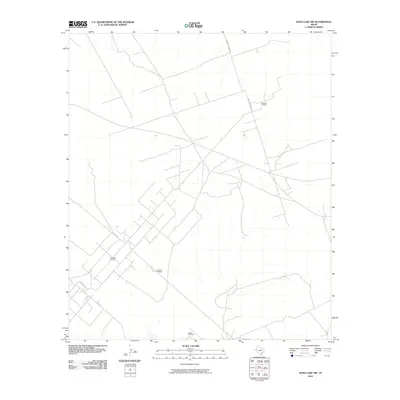
2010 Map of Soda Lake NW
USGS Topo · Published 2010About this map
Energy production and ranching infrastructure define this section of Ward County, Texas, during the first decade of the 21st century. The landscape is characterized by the expansive Meridian Oil Field in the northeast and the Two Freds Oil Field to the southwest, highlighting the region's industrial focus. A network of rural county roads, including Co Rd 200 and Anderson Ranch Rd, provides access across the arid terrain to various resource extraction points. Isolated landmarks such as the Red Tank Windmill and Fence Windmill suggest the underlying ranching heritage that persists alongside the oil and gas developments. This survey provides a precise look at the distribution of wells, tanks, and local transportation routes just as modern digital mapping standards were being refined.
Find a feature on this map
8 named features on this map. Tap any name to fly to it.
Don’t see what you’re looking for? This feature index may not catch every label — zoom into the map to look around manually.
Map Details
Editions of this 2010 Soda Lake NW Map
This is the sole edition of this map. No revisions or reprints were ever made.
Other maps of this area

1954 · Pecos
USGS Topo · 1:250,000

1957 · Pecos
USGS Topo · 1:250,000

1961 · Soda Lake
USGS Topo · 1:24,000

1961 · Mentone
USGS Topo · 1:24,000

1961 · Sand Lake
USGS Topo · 1:24,000

1967 · Soda Lake NW
USGS Topo · 1:24,000

1968 · Soda Lake SE
USGS Topo · 1:24,000

1968 · Soda Lake NE
USGS Topo · 1:24,000

1969 · Cheyenne Draw SW
USGS Topo · 1:24,000
1969 · Rudd Draw
USGS Topo · 1:24,000