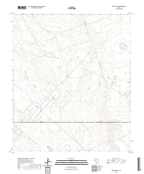
2022 Map of Soda Lake NW
USGS Topo · Published 2022About this map
The boundary line between Loving Co and Ward Co divides this West Texas landscape, a region defined by its sparse infrastructure and vast stretches of open terrain. Remote ranch roads provide the primary access through the area, with Anderson Ranch Rd cutting through the northern portion and Co Rd 200 and Co Rd 160 serving the southwestern sections. The map reveals the characteristic topographical patterns of the Permian Basin, where small depressions and subtle elevation changes suggest the presence of intermittent water features or playas in an otherwise arid environment. This 2022 survey documents the modern layout of these high-desert routes at a time when the region's energy and ranching interests remain its primary geographic markers.
Find a feature on this map
4 named features on this map. Tap any name to fly to it.
Don’t see what you’re looking for? This feature index may not catch every label — zoom into the map to look around manually.
Map Details
Editions of this 2022 Soda Lake NW Map
This is the sole edition of this map. No revisions or reprints were ever made.
Other maps of this area

1954 · Pecos
USGS Topo · 1:250,000

1957 · Pecos
USGS Topo · 1:250,000

1961 · Soda Lake
USGS Topo · 1:24,000

1961 · Mentone
USGS Topo · 1:24,000

1961 · Sand Lake
USGS Topo · 1:24,000

1967 · Soda Lake NW
USGS Topo · 1:24,000

1968 · Soda Lake SE
USGS Topo · 1:24,000

1968 · Soda Lake NE
USGS Topo · 1:24,000

1969 · Cheyenne Draw SW
USGS Topo · 1:24,000
1969 · Rudd Draw
USGS Topo · 1:24,000