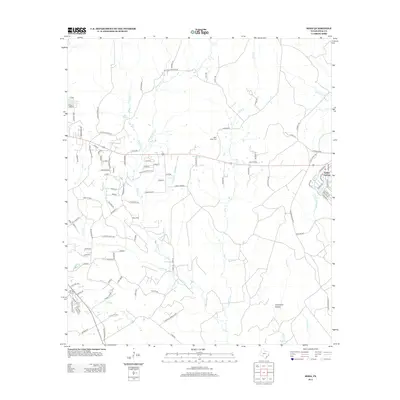
2013 Map of Soda
USGS Topo · Published 2013About this map
Menard Creek and its many tributaries, including Mathis Branch and Beech Creek, dominate this central Polk County landscape. The mapping shows a transition from rural residential clusters like Crystal Lakes Est and Madisonville toward the more established community of Indian Springs in the east. Local history is anchored by the Bluff Creek Cem, situated near the headwaters of Bluff Creek. The road network reveals a series of localized developments such as Soda Central and the Buffalo Subdivision, which are woven into a terrain defined by named features like Bull Run and Greenbriar Hollow. This 2013 survey provides a clear view of how residential expansion has integrated with the natural creek systems of the Piney Woods region.
Find a feature on this map
108 named features on this map. Tap any name to fly to it.
Don’t see what you’re looking for? This feature index may not catch every label — zoom into the map to look around manually.
Map Details
Editions of this 2013 Soda Map
This is the sole edition of this map. No revisions or reprints were ever made.
Other maps of this area

1954 · Beaumont
USGS Topo · 1:250,000

1955 · Camden
USGS Topo · 1:62,500

1955 · New Willard
USGS Topo · 1:62,500

1957 · Beaumont
USGS Topo · 1:250,000

1958 · Livingston
USGS Topo · 1:62,500

1958 · Segno
USGS Topo · 1:62,500

1984 · Segno
USGS Topo · 1:24,000

1984 · Hortense
USGS Topo · 1:24,000

1984 · Soda
USGS Topo · 1:24,000

1984 · Beaumont
USGS Topo · 1:250,000