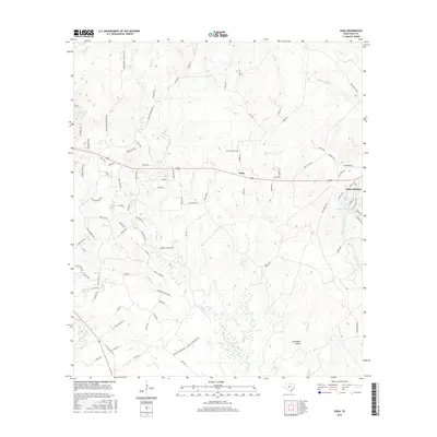
2016 Map of Soda
USGS Topo · Published 2016About this map
Menard Creek meanders through this portion of Polk County, defining a landscape marked by scattered settlements and ancestral burial grounds. The community of Soda serves as a central point, situated along a network of country roads including Wilson Road and Frost Road. To the east, Indian Springs sits near the shores of Lake Winnipesaukee, while Dogwood Lake marks the northwestern corner. The area is heavily defined by its creek systems, with Bluff Creek and Choates Creek draining the timbered terrain. For those tracing family histories in the region, several documented graveyards are located here, such as Broncewell Cemetary, Nettles Cemetery, and Bluff Creek Cem. This 2016 record illustrates how established family names like Kelly and Darden remain etched into the local geography through the naming of its rural thoroughfares.
Find a feature on this map
97 named features on this map. Tap any name to fly to it.
Don’t see what you’re looking for? This feature index may not catch every label — zoom into the map to look around manually.
Map Details
Editions of this 2016 Soda Map
This is the sole edition of this map. No revisions or reprints were ever made.
Other maps of this area

1954 · Beaumont
USGS Topo · 1:250,000

1955 · Camden
USGS Topo · 1:62,500

1955 · New Willard
USGS Topo · 1:62,500

1957 · Beaumont
USGS Topo · 1:250,000

1958 · Livingston
USGS Topo · 1:62,500

1958 · Segno
USGS Topo · 1:62,500

1984 · Segno
USGS Topo · 1:24,000

1984 · Hortense
USGS Topo · 1:24,000

1984 · Soda
USGS Topo · 1:24,000

1984 · Beaumont
USGS Topo · 1:250,000