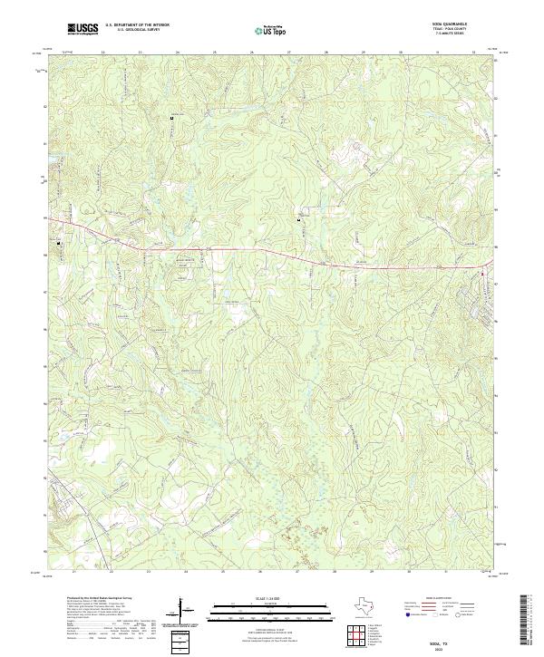
2022 Map of Soda
USGS Topo · Published 2022About this map
The timberlands and creek bottoms of Polk County define this landscape, where the rural crossroads of Soda Central and the residential clusters of Presidio and Encino sit along the east-west corridor of Highway 190. The area is deeply etched by a network of waterways including the meandering Menard Creek and Bluff Creek, which flows through the lowlands of Greenbriar Hollow. Genealogists will find several family-named landmarks and historical burial sites preserved here, including Nettles Cemetery in the north and Bluff Creek Cemetery tucked away near the center of the sheet. In the northwest corner, Dogwood Lake and Choates Creek mark the local topography. This portion of the Piney Woods remains characterized by scattered homesites and names like Johnsons Mill Creek that suggest a long history of local water-driven industry and timber management.
Find a feature on this map
101 named features on this map. Tap any name to fly to it.
Don’t see what you’re looking for? This feature index may not catch every label — zoom into the map to look around manually.
Map Details
Editions of this 2022 Soda Map
This is the sole edition of this map. No revisions or reprints were ever made.
Other maps of this area

1954 · Beaumont
USGS Topo · 1:250,000

1955 · Camden
USGS Topo · 1:62,500

1955 · New Willard
USGS Topo · 1:62,500

1957 · Beaumont
USGS Topo · 1:250,000

1958 · Livingston
USGS Topo · 1:62,500

1958 · Segno
USGS Topo · 1:62,500

1984 · Segno
USGS Topo · 1:24,000

1984 · Hortense
USGS Topo · 1:24,000

1984 · Soda
USGS Topo · 1:24,000

1984 · Beaumont
USGS Topo · 1:250,000