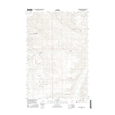
2017 Map of Soda Springs NW
USGS Topo · Published 2017About this map
The south-central edge of Billings meets the winding Yellowstone River in this 2017 survey of Yellowstone County. While the northern section shows the city's residential expansion through roads like Briarwood Blvd and Weldon Rd, the southern portion remains defined by a network of drainage systems and deep geographical depressions. Waterways including Blue Cr and Bitter Cr cut through the terrain, leading toward larger features like Big Coulee. This landscape transition illustrates the meeting point between urban development and the semi-arid ranching lands of Montana. The naming of smaller tracks such as Heyu Cow Ranch Rd, Cattle Feeders Rd, and Freight Trl highlights the enduring agricultural and livestock-focused identity of the area just outside the metropolitan center, providing a clear view of how modern infrastructure and traditional land use coexist.
Find a feature on this map
43 named features on this map. Tap any name to fly to it.
Don’t see what you’re looking for? This feature index may not catch every label — zoom into the map to look around manually.
Map Details
Editions of this 2017 Soda Springs NW Map
This is the sole edition of this map. No revisions or reprints were ever made.
Other maps of this area

1893 · Huntley
USGS Topo · 1:125,000

1954 · Billings
USGS Topo · 1:250,000

1956 · Yegen
USGS Topo · 1:24,000

1956 · Billings East
USGS Topo · 1:24,000

1957 · Billings
USGS Topo · 1:250,000

1957 · Billings West
USGS Topo · 1:24,000

1958 · Billings
USGS Topo · 1:250,000

1967 · Soda Springs NW
USGS Topo · 1:24,000

1967 · Soda Springs
USGS Topo · 1:24,000

1967 · Cottonwood Creek
USGS Topo · 1:24,000