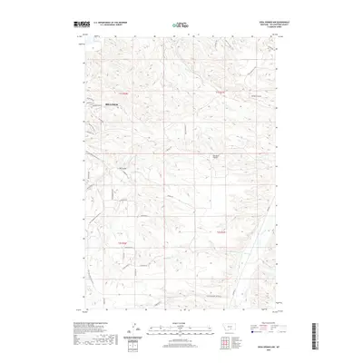
2020 Map of Soda Springs NW
USGS Topo · Published 2020About this map
Billings residential expansion meets the high, dissected landscape of Yellowstone County in this 2020 record. The suburban edges of the city, marked by streets like Briarwood Blvd and Turnberry Cir, contrast sharply with the expansive drainage systems of Big Coulee and Sue Jane Coulee to the south. The terrain is defined by a network of intermittent waterways, including Blue Cr and Bitter Cr, which carve through the benchlands. Local movement is governed by a mix of modern infrastructure like State Secondary Hwy No 416 and older pathways like the Freight Trl. This documentation of the urban-rural interface preserves the specific road names and property boundaries of the t1s r26e and t2s r27e townships, capturing a period of transition as the city grows into the surrounding high country.
Find a feature on this map
41 named features on this map. Tap any name to fly to it.
Don’t see what you’re looking for? This feature index may not catch every label — zoom into the map to look around manually.
Map Details
Editions of this 2020 Soda Springs NW Map
This is the sole edition of this map. No revisions or reprints were ever made.
Other maps of this area

1893 · Huntley
USGS Topo · 1:125,000

1954 · Billings
USGS Topo · 1:250,000

1956 · Yegen
USGS Topo · 1:24,000

1956 · Billings East
USGS Topo · 1:24,000

1957 · Billings
USGS Topo · 1:250,000

1957 · Billings West
USGS Topo · 1:24,000

1958 · Billings
USGS Topo · 1:250,000

1967 · Soda Springs NW
USGS Topo · 1:24,000

1967 · Soda Springs
USGS Topo · 1:24,000

1967 · Cottonwood Creek
USGS Topo · 1:24,000