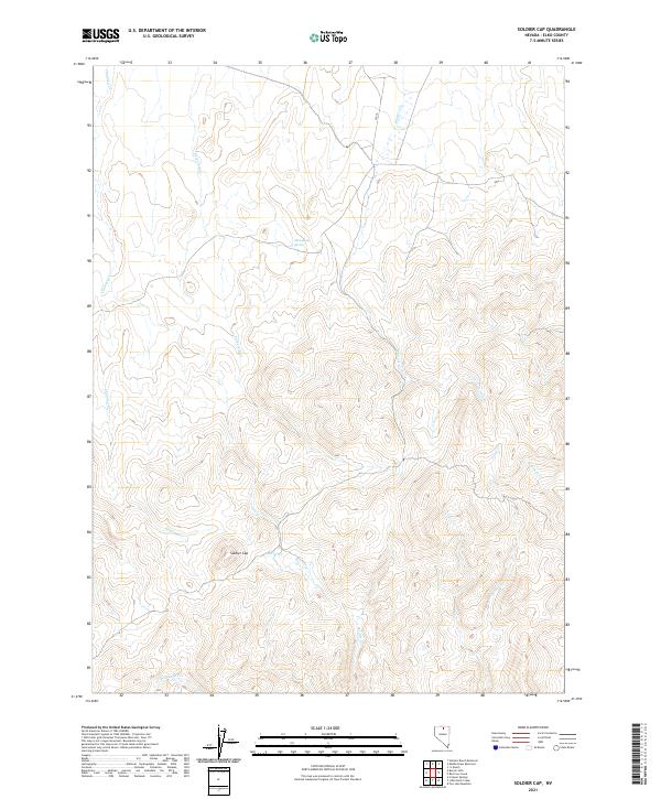
2021 Map of Soldier Cap
USGS Topo · Published 2021About this map
Soldier Cap rises as a prominent landmark in this high-altitude corner of Elko County, defining a landscape shaped by a complex drainage network. The terrain is articulated by numerous seasonal and perennial watercourses including Chimney Cr, Threemile Cr, and Winters Cr, which carve through the high-elevation basins of the Independence Mountains. A critical water source in this arid environment is Mahogany Spring, located in the northern reaches of the quadrangle. The map illustrates the fundamental township and range grid system, showing the intersections of T41N and T42N with R48E and R49E. This area is characterized by its drainage into the Owyhee River system via creeks like Soldier Cr and Trout Cr, reflecting the remote, resource-focused land use of northeastern Nevada in the early 21st century.
Find a feature on this map
16 named features on this map. Tap any name to fly to it.
Don’t see what you’re looking for? This feature index may not catch every label — zoom into the map to look around manually.
Map Details
Editions of this 2021 Soldier Cap Map
This is the sole edition of this map. No revisions or reprints were ever made.
Other maps of this area

1955 · McDermitt
USGS Topo · 1:250,000

1956 · Mt. Blitzen
USGS Topo · 1:62,500

1959 · McDermitt
USGS Topo · 1:250,000

1964 · Wilson Reservoir
USGS Topo · 1:62,500

1973 · Little Rock Creek
USGS Topo · 1:24,000

1974 · Soldier Cap
USGS Topo · 1:24,000

1974 · Middle Draw Reservoir
USGS Topo · 1:24,000

1974 · Winters Ranch Reservoir
USGS Topo · 1:24,000

1974 · Burner Hills
USGS Topo · 1:24,000

1977 · Scraper Springs
USGS Topo · 1:24,000