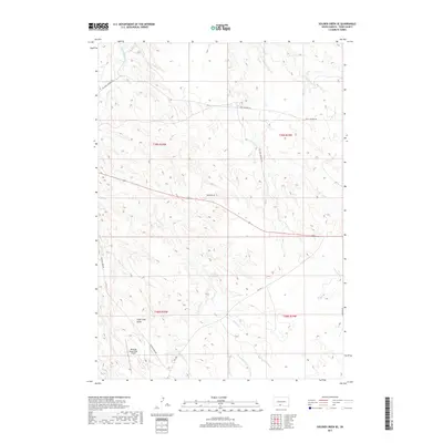
2017 Map of Soldier Creek SE
USGS Topo · Published 2017About this map
Rosebud Sioux Tribal Airport anchors the southern portion of this landscape within Todd County, where the plains are deeply etched by a complex network of waterways. The Little White River and Little Oak Cr navigate the northern reaches, while the central terrain is defined by the winding course of Soldier Cr and its tributary, W Br Soldier Cr. This drainage pattern supports localized features such as Swift Bear Lake and the marshy areas near Wigwam Cr. Significant elevation changes are marked by Sugar Loaf Butte, a prominent landmark rising above the surrounding draws. The road network, including Old Ring Thunder Rd and BIA Hwy 1, reflects the modern infrastructure of the Rosebud Indian Reservation, connecting remote homesites and tribal facilities across the expansive prairie.
Find a feature on this map
19 named features on this map. Tap any name to fly to it.
Don’t see what you’re looking for? This feature index may not catch every label — zoom into the map to look around manually.
Map Details
Editions of this 2017 Soldier Creek SE Map
This is the sole edition of this map. No revisions or reprints were ever made.
Other maps of this area

1955 · Martin
USGS Topo · 1:250,000

1958 · Martin
USGS Topo · 1:250,000

1969 · Soldier Creek NE
USGS Topo · 1:24,000

1969 · Soldier Creek
USGS Topo · 1:24,000

1969 · Mission NW
USGS Topo · 1:24,000

1969 · Mission
USGS Topo · 1:24,000

1969 · Soldier Creek NW
USGS Topo · 1:24,000

1969 · Soldier Creek SE
USGS Topo · 1:24,000

1969 · Olsonville NW
USGS Topo · 1:24,000

1969 · Rosebud
USGS Topo · 1:24,000