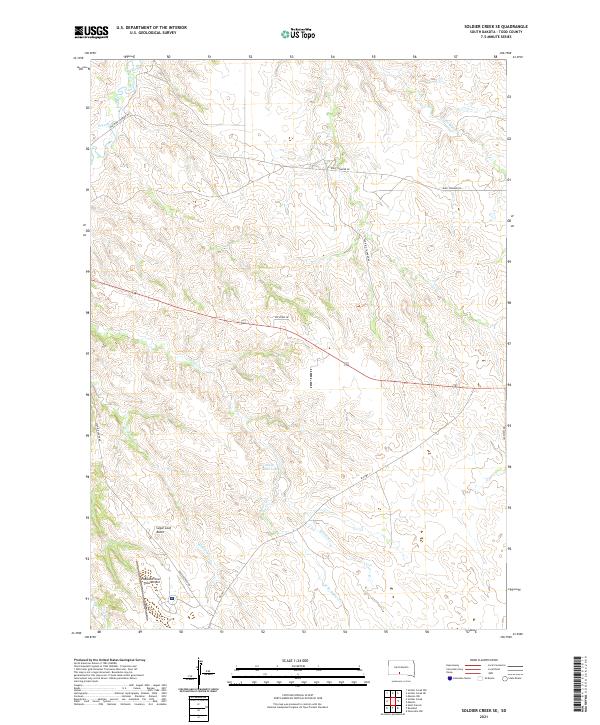
2021 Map of Soldier Creek SE
USGS Topo · Published 2021About this map
The Little White River meanders across this corner of Todd County, defining a landscape etched by a complex drainage network including Soldier Cr and Wigwam Cr. The terrain is characterized by the prominent Sugar Loaf Butte and the presence of Swift Bear Lake, reflecting the natural geography of the Rosebud Indian Reservation. The area’s aviation and transportation infrastructure are centered around the Rosebud Sioux Tribal Airport, which serves as a vital point of connection in this prairie environment.
Find a feature on this map
20 named features on this map. Tap any name to fly to it.
Don’t see what you’re looking for? This feature index may not catch every label — zoom into the map to look around manually.
Map Details
Editions of this 2021 Soldier Creek SE Map
This is the sole edition of this map. No revisions or reprints were ever made.
Other maps of this area

1955 · Martin
USGS Topo · 1:250,000

1958 · Martin
USGS Topo · 1:250,000

1969 · Soldier Creek NE
USGS Topo · 1:24,000

1969 · Soldier Creek
USGS Topo · 1:24,000

1969 · Mission NW
USGS Topo · 1:24,000

1969 · Mission
USGS Topo · 1:24,000

1969 · Soldier Creek NW
USGS Topo · 1:24,000

1969 · Soldier Creek SE
USGS Topo · 1:24,000

1969 · Olsonville NW
USGS Topo · 1:24,000

1969 · Rosebud
USGS Topo · 1:24,000