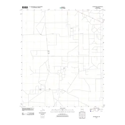
2010 Map of Soldier Hill
USGS Topo · Published 2010About this map
The high plains of Lea County are defined by a network of ranching roads and extractive industry, centered around the landform known as Soldier Hill. This landscape shows a clear layering of historical land use, where cattle ranching interests like Fort Ranch and landmarks such as the Speed Windmill intersect with the energy infrastructure of the Moore Oil Field, Caprock East Oil Field, and Caprock North Oil Field.
Find a feature on this map
11 named features on this map. Tap any name to fly to it.
Don’t see what you’re looking for? This feature index may not catch every label — zoom into the map to look around manually.
Map Details
Editions of this 2010 Soldier Hill Map
This is the sole edition of this map. No revisions or reprints were ever made.
Other maps of this area

1954 · Brownfield
USGS Topo · 1:250,000

1958 · Brownfield
USGS Topo · 1:250,000

1962 · Brownfield
USGS Topo · 1:250,000

1973 · Mescalero Point
USGS Topo · 1:24,000

1973 · Soldier Hill
USGS Topo · 1:24,000

1973 · Caprock
USGS Topo · 1:24,000

1973 · Caudill Ranch
USGS Topo · 1:24,000

1973 · Cooper-Good Ranch
USGS Topo · 1:24,000

1973 · Mescalero Point NE
USGS Topo · 1:24,000
1973 · Frier Ranch
USGS Topo · 1:24,000