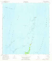
1956 Map of Soldier Key
USGS Topo · Published 1976About this map
Soldier Key and the northern reaches of Sands Key anchor this mid-century maritime study of the transition from Biscayne Bay to the open Atlantic Ocean. The map documents a landscape defined by water and shoals, tracing the delicate chain of the Ragged Keys and the submerged hazards of Black Ledge and Featherbed Bank. A lone Lookout Tower stands on the southernmost of the Ragged Keys, providing a rare terrestrial waypoint in a region dominated by navigational aids like the Intracoastal Waterway and various daybeacons.
Find a feature on this map
21 named features on this map. Tap any name to fly to it.
Don’t see what you’re looking for? This feature index may not catch every label — zoom into the map to look around manually.
Map Details
Editions of this 1956 Soldier Key Map
3 editions found
Other maps of this area

1947 · Key Biscayne
USGS Topo · 1:24,000

1948 · Soldier Key
USGS Topo · 1:24,000

1949 · Elliott Key
USGS Topo · 1:24,000

1949 · Key Biscayne
USGS Topo · 1:24,000

1949 · Arsenicker Keys
USGS Topo · 1:24,000

1949 · Perrine
USGS Topo · 1:24,000

1950 · South Miami
USGS Topo · 1:24,000
1956 · Elliott Key
USGS Topo · 1:24,000

1956 · Perrine
USGS Topo · 1:24,000

1956 · South Miami
USGS Topo · 1:24,000