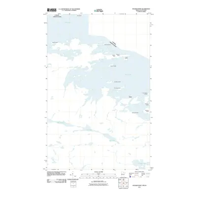
2011 Map of Soldier Point
USGS Topo · Published 2011About this map
Rainy Lake dominates this northern border landscape, where the international boundary between the United States and Canada weaves through a complex archipelago. This 2011 survey illustrates a wilderness defined by water and rock, featuring numerous named landforms such as Soldier Point, Gaylord Point, and Hitchcock Island. The interior terrain south of the main lake body reveals a network of smaller, secluded basins including War Club Lake, Quill Lake, and Loiten Lake, connected by minor waterways like Sucker Creek and Clyde Creek. This area of the Rainy River District is characterized by its labyrinthine shoreline and the absence of established road infrastructure, highlighting a region where travel remains primarily waterborne. Notable landmarks like Three Sisters Islands and Finlander Island serve as essential navigational points within the expansive reach of the border waters.
Find a feature on this map
22 named features on this map. Tap any name to fly to it.
Don’t see what you’re looking for? This feature index may not catch every label — zoom into the map to look around manually.
Map Details
Editions of this 2011 Soldier Point Map
This is the sole edition of this map. No revisions or reprints were ever made.
Other maps of this area

1954 · International Falls
USGS Topo · 1:250,000

1957 · International Falls
USGS Topo · 1:250,000

1958 · International Falls
USGS Topo · 1:250,000

1967 · Kempton Bay
USGS Topo · 1:24,000

1968 · Soldier Point
USGS Topo · 1:24,000

1968 · Daley Bay
USGS Topo · 1:24,000

1968 · Ash River NE
USGS Topo · 1:24,000

1969 · Cranberry Bay
USGS Topo · 1:24,000

1969 · Kabetogama
USGS Topo · 1:24,000
1978 · International Falls
USGS Topo · 1:100,000