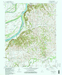
1981 Map of Solitude
USGS Topo · Published 1981About this map
New Harmony anchors the northeastern corner of this landscape, a historic settlement defined by the winding course of the Wabash River. The river's dynamic nature is evident through remnant features like Wabash River (Old Channel) and the horseshoe-shaped Hawthorne Bend, which together isolate large land masses such as Ribeyre Island and Mink Island. Cultural landmarks including The Labyrinth State Memorial and Murphy Park highlight the region's communal history, while the sprawling Harmonie State Park occupies a significant portion of the timbered river bluffs. Further south, the landscape transitions into agricultural flats and industrial zones, notably the Hawthorne Oil Field. Small rural centers such as Savah and Solitude are connected by a network of drainage ways including Gresham Creek and Rush Creek, with local heritage preserved at the Bethesda Ch and Alexander Cem.
Find a feature on this map
51 named features on this map. Tap any name to fly to it.
Don’t see what you’re looking for? This feature index may not catch every label — zoom into the map to look around manually.
Map Details
Editions of this 1981 Solitude Map
2 editions found
Other maps of this area

1903 · New Harmony
USGS Topo · 1:62,500

1903 · Patoka
USGS Topo · 1:125,000

1905 · New Haven
USGS Topo · 1:62,500

1906 · New Haven
USGS Topo · 1:62,500

1917 · Uniontown
USGS Topo · 1:62,500

1938 · New Harmony
USGS Topo · 1:62,500

1940 · Carmi
USGS Topo · 1:62,500

1943 · Carmi
USGS Topo · 1:62,500

1949 · Paducah
USGS Topo · 1:250,000

1949 · New Haven
USGS Topo · 1:62,500