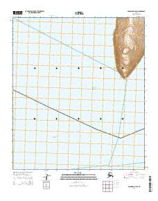
2014 Map of Solomon B-2 SW
USGS Topo · Published 2014About this map
Cape Darby anchors this coastal landscape where the land meets the northern waters of Norton Sound. This part of the Seward Peninsula, documented in 2014, is defined by the steep elevation changes rising from the shoreline of the Bering Sea. The map captures a solitary transportation route, Cape Darby Road, which winds across the high ground toward the coast.
Find a feature on this map
8 named features on this map. Tap any name to fly to it.
Don’t see what you’re looking for? This feature index may not catch every label — zoom into the map to look around manually.
Map Details
Editions of this 2014 Solomon B-2 SW Map
This is the sole edition of this map. No revisions or reprints were ever made.
Other maps of this area

1950 · Solomon B-3
USGS Topo · 1:63,360

1950 · Solomon B-2
USGS Topo · 1:63,360

1950 · Solomon
USGS Topo · 1:250,000

1951 · Solomon
USGS Topo · 1:250,000

2014 · Solomon B-2 NE
USGS Topo · 1:25,000

2014 · Solomon B-2 NW
USGS Topo · 1:25,000
2014 · Solomon B-3 NE
USGS Topo · 1:25,000
2014 · Solomon B-2 SE
USGS Topo · 1:25,000