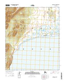
2014 Map of Solomon C-1 NE
USGS Topo · Published 2014About this map
Moses Point Fishing Village stands on the narrow spit separating the marshy lowlands of the Kwiniuk River from the waters of Norton Bay. This coastal landscape is defined by its isolation and its reliance on the seasonal movements of the river and sea. The presence of the Moses Point Airport and Harbor Road indicates the area's role as a small but vital transportation node on the Seward Peninsula. To the west, the terrain rises sharply from the shoreline, with Iron Cr cutting through the hills. This 2014 survey captures the layout of the fishing camp and the Moses Point Road as it winds along the coast, providing a clear view of the infrastructure supporting this remote settlement.
Find a feature on this map
13 named features on this map. Tap any name to fly to it.
Don’t see what you’re looking for? This feature index may not catch every label — zoom into the map to look around manually.
Map Details
Editions of this 2014 Solomon C-1 NE Map
This is the sole edition of this map. No revisions or reprints were ever made.
Other maps of this area

1948 · Norton Bay
USGS Topo · 1:250,000

1950 · Norton Bay D-6
USGS Topo · 1:63,360

1950 · Solomon C-1
USGS Topo · 1:63,360

1950 · Norton Bay C-6
USGS Topo · 1:63,360

1950 · Solomon D-1
USGS Topo · 1:63,360

1950 · Solomon
USGS Topo · 1:250,000

1951 · Solomon
USGS Topo · 1:250,000

1951 · Norton Bay
USGS Topo · 1:250,000

1955 · Norton Bay
USGS Topo · 1:250,000
2014 · Solomon C-1 SE
USGS Topo · 1:25,000