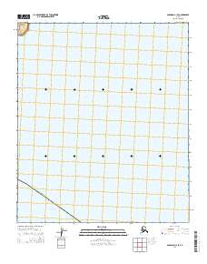
2014 Map of Solomon C-1 SE
USGS Topo · Published 2014About this map
Norton Bay dominates the central and eastern portions of this coastal landscape on the Seward Peninsula. The maritime environment is the defining characteristic of this 2014 survey, which covers a remote section of the Nome Census Area. The survey depicts a largely undeveloped interface between the Bering Sea and the Alaskan interior, primarily defined by the legal boundaries of township t10s r18w. The absence of roads, settlements, or structures reflects the sheer isolation of this subarctic terrain, where the focus is entirely on the vast expanse of tidal water and the administrative divisions of the public land survey system. This map is essential for understanding the modern shoreline and the formal organization of these outlying coastal lands before further environmental or infrastructure changes occur.
Find a feature on this map
15 named features on this map. Tap any name to fly to it.
Don’t see what you’re looking for? This feature index may not catch every label — zoom into the map to look around manually.
Map Details
Editions of this 2014 Solomon C-1 SE Map
This is the sole edition of this map. No revisions or reprints were ever made.
Other maps of this area

1948 · Norton Bay
USGS Topo · 1:250,000

1950 · Solomon C-1
USGS Topo · 1:63,360

1950 · Norton Bay C-6
USGS Topo · 1:63,360

1950 · Solomon
USGS Topo · 1:250,000

1951 · Solomon
USGS Topo · 1:250,000

1951 · Norton Bay
USGS Topo · 1:250,000

1955 · Norton Bay
USGS Topo · 1:250,000
2014 · Solomon C-1 NE
USGS Topo · 1:25,000
2014 · Solomon C-1 SW
USGS Topo · 1:25,000
2014 · Solomon C-1 NW
USGS Topo · 1:25,000