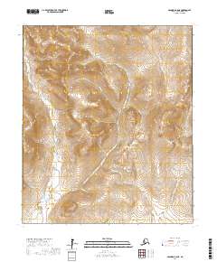
2017 Map of Solomon C-6 NE
USGS Topo · Published 2017About this map
The Seward Peninsula landscape is defined by the winding course of the Bonanza River, which drains a complex network of tributary creeks including California Cr, Willow Cr, and Gold Cr. This 2017 study of the Solomon C-6 NE quadrangle shows a region devoid of modern infrastructure or permanent settlements, instead focusing on the hydrological and topographical detail of the interior. The drainage patterns of named waterways like Fox Cr and Harrison Cr suggest a terrain of seasonal flows and varied elevations typical of this Alaskan subarctic environment. For those tracing the geography of the Nome Census Area, this map provides precise locations for remote water bodies such as Bruch Cr, Alta Cr, and West Cr, offering a detailed view of the natural landscape and its local naming conventions.
Find a feature on this map
19 named features on this map. Tap any name to fly to it.
Don’t see what you’re looking for? This feature index may not catch every label — zoom into the map to look around manually.
Map Details
Editions of this 2017 Solomon C-6 NE Map
This is the sole edition of this map. No revisions or reprints were ever made.
Other maps of this area

1907 · Casadepaga
USGS Topo · 1:62,500

1907 · Solomon
USGS Topo · 1:62,500

1950 · Solomon C-5
USGS Topo · 1:63,360

1950 · Solomon C-6
USGS Topo · 1:63,360

1950 · Solomon
USGS Topo · 1:250,000

1950 · Solomon D-6
USGS Topo · 1:63,360

1950 · Solomon D-5
USGS Topo · 1:63,360

1951 · Solomon
USGS Topo · 1:250,000
2017 · Solomon D-5 SW
USGS Topo · 1:25,000
2017 · Solomon C-6 NW
USGS Topo · 1:25,000