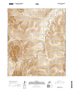
2017 Map of Solomon D-5 SW
USGS Topo · Published 2017About this map
The Casadepaga River and Solomon River carve through this interior portion of the Seward Peninsula, a landscape shaped by the legacies of Alaskian gold prospecting. The drainage patterns revealed here, including Allgold Cr, Moonlight Cr, and Bonita Cr, point toward the area's mining heritage. These named waterways fed into larger systems where operations once flourished in the early 20th century. Named terrain features like Homestake Gulch, Ida Gulch, and Willow Gulch highlight specific sites of interest for those studying the physical history of the Nome Census Area. The map details the complex network of tributaries such as Lower Willow Cr and Banner Cr that define the watershed between these two significant river systems.
Find a feature on this map
41 named features on this map. Tap any name to fly to it.
Don’t see what you’re looking for? This feature index may not catch every label — zoom into the map to look around manually.
Map Details
Editions of this 2017 Solomon D-5 SW Map
This is the sole edition of this map. No revisions or reprints were ever made.
Other maps of this area

1907 · Casadepaga
USGS Topo · 1:62,500

1907 · Solomon
USGS Topo · 1:62,500

1950 · Solomon C-5
USGS Topo · 1:63,360

1950 · Solomon C-6
USGS Topo · 1:63,360

1950 · Solomon
USGS Topo · 1:250,000

1950 · Solomon D-6
USGS Topo · 1:63,360

1950 · Solomon D-5
USGS Topo · 1:63,360

1951 · Solomon
USGS Topo · 1:250,000
2017 · Solomon D-5 NW
USGS Topo · 1:25,000
2017 · Solomon D-5 SE
USGS Topo · 1:25,000